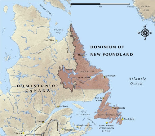
Map of Newfoundland in 1914

See enlarged version of this map here. You can also download a hi-res copy as a pdf (10.5 mbs).
This map shows the Dominion of Newfoundland at the time it entered the First World War in 1914.
Credit
Map produced by Geographx with research assistance from Damien Fenton and Caroline Lord.

This work is licensed under the Creative Commons
Attribution-ShareAlike 3.0 New Zealand License
Permissions beyond the scope of this license may be available here
Bookmark/Search this post with
How to cite this page: 'Map of Newfoundland in 1914', URL: http://www.nzhistory.net.nz/media/photo/map-newfoundland-1914, (Ministry for Culture and Heritage), updated 29-Jul-2014
The Map of the Dominion of Newfoundland in 1914 is incorrect. The Labrador section contained only a narrow strip of land along the coastline. See:
http://vimyridgehistory.com/wp-content/gallery/maps-of-canada/

 Facebook
 Google
 Reddit
 StumbleUpon
 Twitter


Community contributions