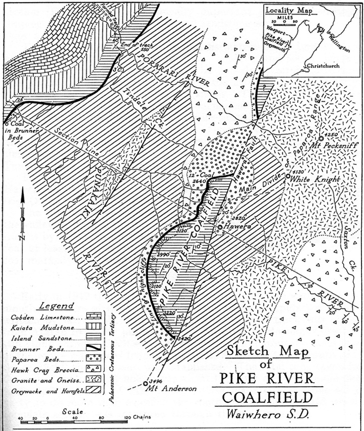
First geological map of the Pike River coalfield, produced by Harold Wellman in 1948. The Brunner coal seam, mined by the Pike River coal company, is within the solid black line which shows the location of the Brunner beds.
NZ Journal of Science & Technology B30(2), 1948, p. 85
How to cite this page
'Pike River coalfield map', URL: http://www.nzhistory.net.nz/media/photo/pike-river-coalfield-map, (Ministry for Culture and Heritage), updated 17-Nov-2015

Community contributions