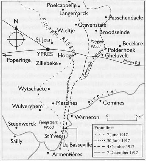
This map shows the main areas of conflict in Belgium during 1917.
See also the following Google maps:
If you have Google earth installed, you can also download a file showing the battle locations. Right click on the link below and choose 'Save Target As' or 'Save Link As' (note you have to download the file before launching it - it can't be launched from your browser):
(Don't want to install Google earth? You can also view a version of this map at Google maps online here - click on yellow 'pins' for more info.)
- See also: Passchendaele interactive map

Community contributions