Credit
Alexander Turnbull Library
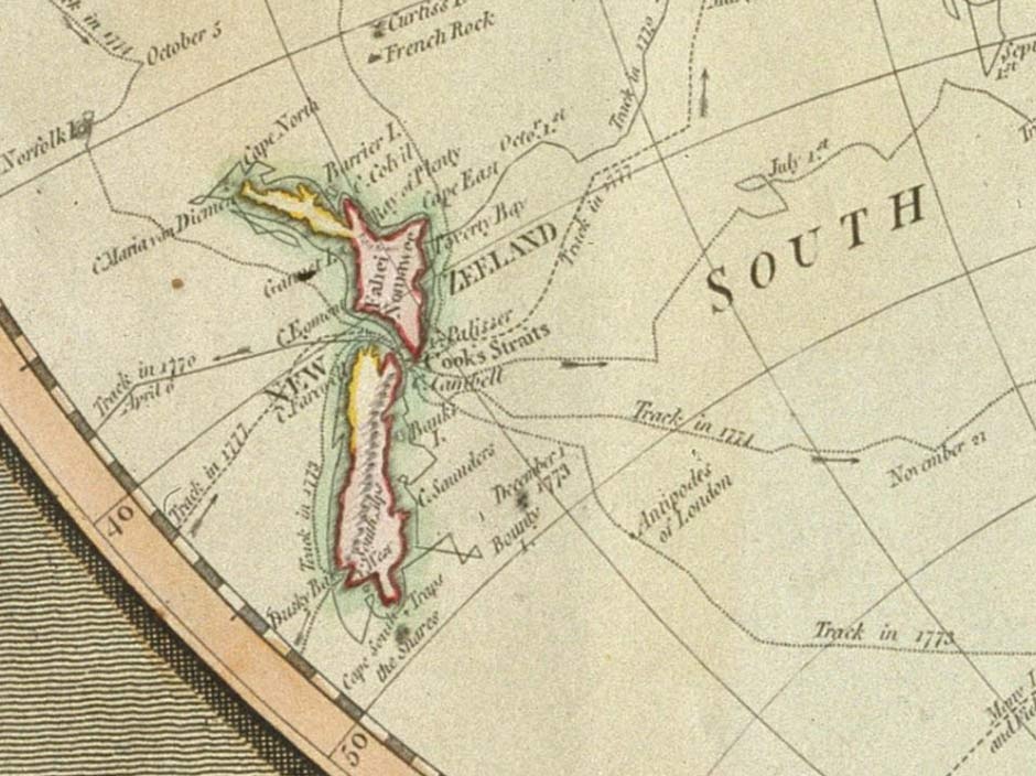
Reference: A new map of the world, published by Laurie & Whittle, 1800
Permission of the Alexander Turnbull Library, National Library of New Zealand, Te Puna Matauranga o Aotearoa must be obtained before any reuse of this image.
How to cite this page
'Map showing Cook's voyages', URL: http://www.nzhistory.net.nz/media/photo/map-showing-cooks-voyages, (Ministry for Culture and Heritage), updated 11-Mar-2014
RELATED TO MAP SHOWING COOK'S VOYAGES
Events
-
18 December 1642
First contact between Māori and Europeans
-
15 November 1769
British flag flies for first time in NZ
-
10 August 1840
British assert sovereignty as French head for Akaroa
-
10 November 1880
Sutherland Falls 'discovered'
-
9 February 1770
Cook completes circumnavigation of North Island
-
16 February 1770
James Cook sights Banks 'Island'
-
12 December 1769
De Surville first sights NZ near Hokianga
-
17 December 1773
Ten crew of Cook's ship Adventure killed and eaten
-
20 May 1773
NZ's first sheep released
-
24 March 1770
Ngāti Kahu kidnap victim dies at sea on French ship
-
8 January 1863
Haast begins West Coast expedition
-
28 January 1827
D'Urville sails through French Pass
-
13 December 1642
First recorded European sighting of New Zealand
-
9 November 1769
Captain Cook observes transit of Mercury
-
12 March 1864
Arthur's Pass 'discovered'
-
6 October 1769
Young Nick sights land
Biographies
-
Thomas Brunner
-
James Cook
-
Charles Heaphy
-
Abel Tasman
Articles
-
Treaty signatories and signing locations
-
Exploring New Zealand's interior
-
Early explorers
Community contributions