
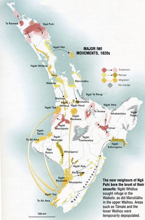
This map shows the major iwi movements of the 1820s caused by the intertribal conflicts known as the Musket Wars. This fighting often drove tribes out of their traditional areas and into exile with extended family.
The near neighbours of Ngāpuhi bore the brunt of their assaults. Ngāti Whātua sought refuge in Waikato, and Marutūahu in the upper Waihou valley, south of the Firth of Thames. Areas such as Tāmaki (Auckland) and the lower Waihou valley were temporarily depopulated.
Community contributions