You can also download a hi-res copy as a pdf (8.7mbs).
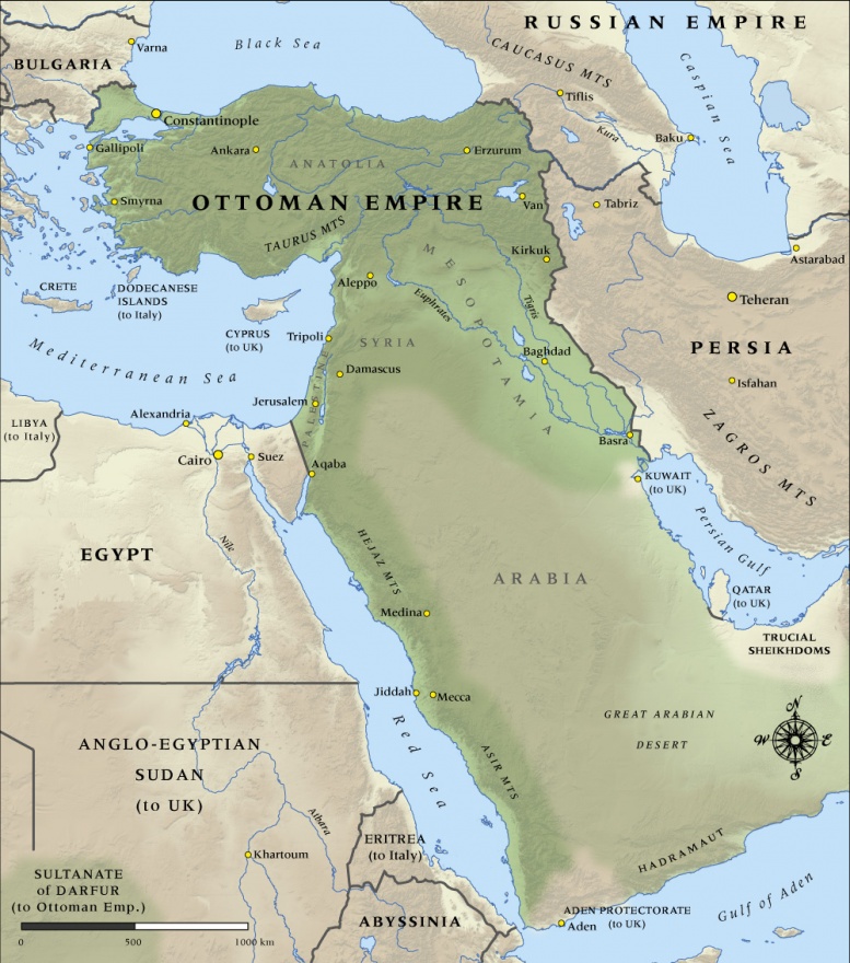
This map shows the boundaries and major cities of the Ottoman Empire at the start of the First World War in 1914.

You can also download a hi-res copy as a pdf (8.7mbs).
This map shows the boundaries and major cities of the Ottoman Empire at the start of the First World War in 1914.
Hi. The borders in Europe and with Russia reflect the current situation, not 1914. The Ottomans ceded a bit of territory to Bulgaria in 1915 (seen here in green http://www.omda.bg/page.php?IDMenu=431&IDLang=2) that is marked incorrectly on this map. The border with Russia reflects the post WW I Soviet/Turkish border rather the Ottoman/border of 1914. The correct border is marked in blue on the map found in this Wikipedia article: http://en.wikipedia.org/wiki/User:Yerevantsi/Soviet_territorial_claims_t...
Hi Friendy - my understanding is that West Thracia was part of Bulgaria at the time the Ottoman Empire entered the FWW in 1914, awarded in the Treaty of Bucharest following the Second Balkan War of 1913. http://en.wikipedia.org/wiki/Western_Thrace
You will see it included on our Buglaria FWW map.
I freely admit this is not an area we have specialist expertise in, so happy to be corrected if we have got this wrong. Regards, Jamie Mackay
Map is wrong. Where is west Thracia?
Community contributions